Garmin 1242xsv Multifunction Display: A Comprehensive Review
Overview
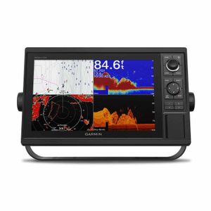
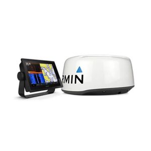
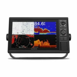
Integrating exceptional features and advanced technology, the Garmin 1242xsv Multifunction Display, serves as an optimal solution for boaters of all levels. Its all-in-one 12-inch chartplotter/sonar combination offers exceptional benefits for the budget-conscious Mariner seeking a network hub equipped with high-end functions. The combo is designed with an easy-to-use keypad interface, featuring user-programmable keys and a multi-function control knob for hassle-free navigation. Furthermore, the multifunction display is compatible with critical accessories such as radars, supporting Panoptix all-seeing sonar and premium Garmin sonar modules. High-resolution mapping includes options for both inland waters, with LakeVu HD, and coastal charts via BlueChart g3 HD. Please note that the transducer is sold separately.
Main Features
- 12-inch color display with keypad interface and multi-function control knob
- Loaded with U.S. LakeVu HD maps and BlueChart g3 HD charts for comprehensive coverage
- High precision with embedded 10 Hz GPS and GLONASS receiver
- Incorporates Garmin’s CHIRP sonar, CHIRP ClearVu and CHIRP SideVu scanning sonar and Panoptix support
- The sharing capability enables the distribution of sonar, maps, user data, dome or open-array radar, IP cameras and Panoptix sonar among multiple units.
- Provides Wi-Fi connectivity for BlueChart Mobile 2.0 and Garmin Helm applications
- All-round connectivity with ANT wireless connection to quatix marine watch, Garmin Nautix in-view display, gWind Wireless 2 transducer, GNX Wind marine instrument, and wireless remote controls
- Sonar capabilities integrated into the combo offers a wealth of sonar features right out of the box. Just add the transducers to access and share internal sonar across the network
Specifications
The display type is Color TFT LCD, with a screen size of 12″ diagonal and a resolution of 1280 x 800. The unit receives U.S. LakeVu HD and BlueChart g3 HD cartography, and a high-sensitivity internal 10 Hz GPS/GLONASS receiver. It supports a range of frequencies, depending on the transducer, with a maximum transmit power of 1 kW (RMS) for traditional sonar and CHIRP. The transducer is sold separately. The unit dimensions are 14 1/8″W x 8 7/8″H x 2 11/16″D and it carries a waterproof rating of IPX7. The product comes with a two-year warranty.
Packaged Contents
Inside the box of the GPSMAP 1242xsv chartplotter, you’ll find a power/data cable, NMEA 2000 T-connector and drop cable (2m), 8-pin transducer to 12-pin sounder adapter cable, bail mount kit with knobs, flush mount kit with gasket, protective cover, trim piece snap covers, and necessary documentation.
Efficient Networking
The Garmin Marine Network facilitates seamless sharing of vital information such as sonar, maps, and other data among multiple gadgets. With NMEA 2000 network connectivity and NMEA 0183 support, it enables integration with autopilots, digital switching, weather, FUSION-Link, VHF, AIS, and other sensors for improved marine navigation.
Built-in Wi-Fi
With the built-in Wi-Fi feature, boaters get the convenience of wireless connectivity for BlueChart Mobile 2.0 and Garmin Helm apps. These features provide boaters with enhanced situational awareness, enabling them to control the chartplotter from a compatible smartphone or tablet.
Built-in Sonar Capabilities
Out-of-the-box, the 1242xsv offers an array of amazing sonar capabilities. The multifunction display is equipped with Garmin 1 kW CHIRP sonar, CHIRP ClearVu, and CHIRP SideVu.
Preloaded Charts
The high-quality Garmin Cartography comes preloaded in the device, comprising of both LakeVu HD and BlueChart g2 HD coastal charts. Users can upgrade these to even better mapping solutions with the two SD card slots provided.
Remarkable SailAssist Features
For competitive sailing, the versatile Garmin multifunction display-equipped race guidance features provide a competitive edge with optimum wind maximization. The race timer can be synced across all networked Garmin GPS devices for precision.
Advanced GPX Transfer
The GPSMAP1242xsv permits easy transfer of waypoints, tracks, or routes from other manufacturers’ GPS products or Garmin handheld devices, using industry-standard GPX software formatting.
Simplified Navigation
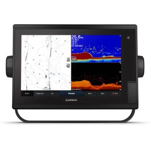
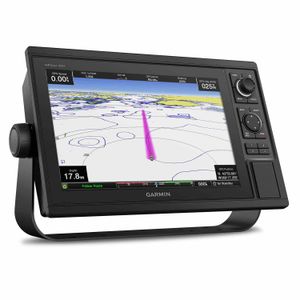
The bright, sunlight-readable 12″ intuitive touchscreen chartplotter simplifies navigation making it accessible in any environmental conditions and easily integrates into your Garmin marine system.
Content Include
The device package includes the GPSMAP 1242xsv Plus chartplotter, a power cable, 8-pin transducer to 12-pin sonar adapter cable, NMEA 2000 T-connector, NMEA 2000 drop cable (2 m), bail mount kit with knobs, flush mount kit with gasket, protective cover, trim piece snap covers, and the relevant documentation.
